
 The mission of the Department of the Geographer is to accurately portray a working interpretation of the Department during the period from 1777 to 1783 with the express goal of portraying the world of the Continental Army staff officer better than has been achieved to date.
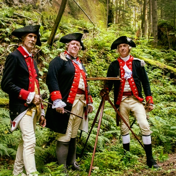
The Department of the Geographer is different in appearance and attitude than much of the Revolutionary War living history community. This is for a purpose. Other units make certain concessions to authenticity or may define themselves as “family organizations,” wherein membership quantity is paramount to quality. We do not. We define ourselves as a military organization in that we represent a staff department of Washington’s headquarters and we do our best to act like officers and soldiers on duty. During duty hours, we follow proper military protocols and soldiers are expected to live a soldier’s life. Our clothing is typically hand-finished and the materials all linen and wool, like what the men of the Continental Army would have worn. Our camp is functional, but not over-furnished. The purpose is present a faithful representation of what life in the Continental Army was like to those who hope to learn from the events we attend, but also that we may have a deeper appreciation for the lives of the men we say we represent.
This sort of living history is not for everyone. There are high expectations on all members, but they are quite attainable, and for those who do, very rewarding. You will have the satisfaction knowing that you are at the peak of the living history experience, not only educating the general public, but yourself as well. There is a gratifying feeling knowing that you know what you are doing, you are doing right, and you will soon find that you will be eager to continue to push the envelope. Along with this, you will find camaraderie among those around you. To those willing to take up the challenge, we welcome you.

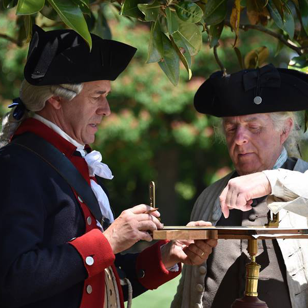
![]() By the onset of the war, large maps showing colonies or groupings of colonies were widely available on the commercial market and formed the basis for strategic planning on both sides of the conflict. What Washington needed more than anything, however, was tactical level maps that would show relatively small areas…counties, neighborhoods, river crossings, roads, mountain ranges. For this task, he appointed Robert Erskine as the first Geographer to the Army.
By the onset of the war, large maps showing colonies or groupings of colonies were widely available on the commercial market and formed the basis for strategic planning on both sides of the conflict. What Washington needed more than anything, however, was tactical level maps that would show relatively small areas…counties, neighborhoods, river crossings, roads, mountain ranges. For this task, he appointed Robert Erskine as the first Geographer to the Army.
In May of 1780, Erskine wrote to Phillip Schuyler, giving an update on the Department’s activities and products:
“From Surveys actually made, we have furnished His Excellency with maps of both sides of the North River, extending from New Windsor and Fishkill, southerly to New York; eastward: to Hartford, Whitehaven, etc., and on the west to Easton in Pennsylvania. Our Surveys likewise include the principal part of New Jersey, lying northward of a line drawn from Sandy Hook to Philadelphia; take in a considerable part of Pennsylvania; extend through the whole route of the Western army under Genl. Sullivan, and are carried on from New Windsor and Fishkill northward, on both sides of the River, to Albany, & from thence to Scoharie. In short, from the Surveys made, and materials collecting and already procured, I could form a pretty accurate Map of the four States of Pennsylvania, New Jersey, New York and Connecticut, and by the help of a few Magnetic and Astronomical Observations, with some additional Surveys, a very accurate one. …the original protractions and plans already surveyed by the Geographers of the Army are contained in upwards of two hundred and fifty sheets of paper; that with a proper number of hands, which I suppose to be five surveyors and two draughtsmen, such additional surveys of the roads and rivers might be taken in the course of a year, as would afford sufficient data for the forming an accurate map of the middle States…”
As would be expected over the course of over 245 years, not all of the “two hundred and fifty sheets of paper” that existed by 1780 still remain, but a remarkable number have been preserved. A few are held in collections at the Library of Congress and New Jersey Historical Society, but the majority of the maps (288 of them) are held at the New York Historical Society (NYHS). As Congress did not authorize the publication of the maps after the war, Simeon DeWitt kept the maps in his private collection. After his death, his son, Richard Varick DeWitt, donated them to the NYHS.
Click on the link below to the Erskine-Dewitt Collection at the NYHS to view additional maps.