By the summer of 1777, George Washington had identified a definite weakness in the Army’s ability to produce adequate topographical data in order to plan and execute theater operations. In July of that year, Washington wrote to Congress, “A good geographer to Survey the Roads and take Sketches of the Country where the Army is to Act would be extremely useful… …I would beg leave to recommend Mr. Robt. Erskine…” [1] Erskine emigrated from Scotland in 1771, was a Fellow of the Royal Society, proprietor of the Ringwood Iron Works in Passaic County, New Jersey, and developed a “Marine Chevaux de Frise” that was successful in sinking a number of British ships. [2]
On August 1, Erskine accepted Washington’s offer, and proceeded to outline the roles and responsibilities of a geographer:
It is then perhaps proper to begin with a general view of the nature of the business in order to shew what may really be accomplished by a Geographer, that more may not be expected than it is practicable to perform; and that an estimate may be made of the number of assistants required should the Map of any particular district be required in a given time. It is obvious that in planning a country a great part of the ground must be walked over, particularly the banks of Rivers and Roads; as much of which may be traced and laid down in three hours as could be walked over in one; or in other words a Surveyor who can walk 15 miles a day may plan 5 miles; if the country is open, and stations of considerable length can be obtained, then perhaps greater dispatch can be made; very little more, however, in general can be expected; if it is considered that the Surveyor, besides attending to the course and measuring the distance of the way he is traversing, should at all convenient places where he can see around him, take observations and angles to Mountains, hills, steeples, houses and other objects which present themselves, in order to fix their site; to correct his work; and to facilitate its being connected with other Surveys. A Surveyor might go to work with two Chain-bearers and himself; but in this case he must carry his own instruments, and some of them must frequently traverse the ground three times over at least; therefore, to prevent this inconvenience and delay, as men enough can be had from Camp without additional expense, six attendants to each surveyor will be proper; to wit, two Chain-bearers, one to carry the Instrument, and three to hold flag staffs; two flags, indeed, are only wanted in common; but three are necessary for running a straight line with dispatch; and the third flag may be usefully employed in several cases besides. From what one Surveyor can do, it will therefore appear that in making a plan, like all other business, the more hands are employed in it, the sooner it may be accomplished; likewise, that the director of the Surveyors will have full employment in making general observations, and connecting the different surveys as they come in, upon one general Map; and, at any rate, that a correct plan must be a work of time.
A great deal however may be done towards the formation of an useful Map, by having some general outlines justly laid down; and the situation of some remarkable places accurately ascertained; from such data, other places may be pointed out, by information and computed distances; in such a manner as to give a tolerable idea of the Country; especially with the assistance of all the maps in being, which can be procured: and this, perhaps, is as much as can be expected, should plans be required to keep pace with the transitions of War.
Navigable Rivers, and those which cannot be easily forded, and likewise the capital roads, should be laid down with all the accuracy possible; but, in the Map of a country, the general course of fordable rivers need only be attended to; it not being practicable to express small windings but on large scale, the same accuracy not being required here which is necessary to ascertain the quantity and boundaries of private property. In general, therefore, the adjacence to, and intersection of, such rivers with roads, will determine their course with sufficient exactness: the situation of woods and mountains, too, may be remarked in a similar manner.
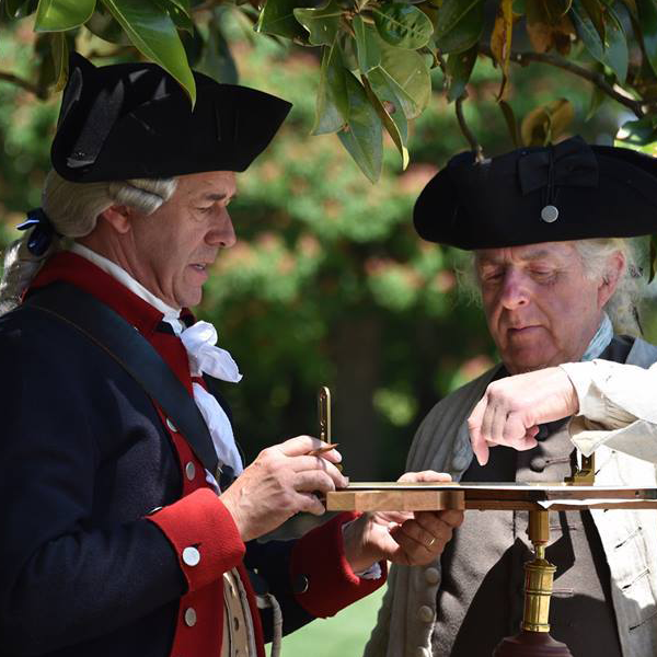
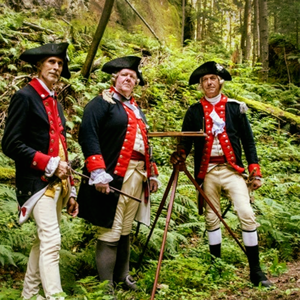
Young gentlemen of Mathematical genius, who are acquainted with the principles of Geometry, and who have a taste for drawing, would be the most proper assistants for a Geographer. Such, in a few days practice, may be made expert surveyors. The instrument best adapted for accuracy and dispatch is the Plain-Table; by this, the Surveyor plans as he proceeds, and-not having his work to protract in the evening -may attend the longer to it in the day. One of these instruments, with a chain and ten iron-shod arrows, should be provided for each of the Surveyors it may be thought proper to employ.[3]
For the next number of months, Erskine worked from his home base at Ringwood and at New Windsor on a number of projects for the Army, including surveys for the fortifications at West Point in conjunction with Col. La Radiere of the Corps of Engineers. Erskine said of La Radiere, “I am happy to assist a gentleman of skill in his profession, from whom much of the art of practical Engineering may be learnt.” Erskine also conducted surveys and levels of Forts Constitution and Montgomery.[4]
On June 1st, 1778, Erskine arrived at the army’s encampment at Valley Forge.[5] Four days later, Washington wrote to Capt. William Scull of the 11th Pennsylvania, who was conducting surveys of the area under the direction of Washington and the War Board. Washington reported that, “Robert Erskine Esqr., who is appointed Military Surveyor, and Geographer is now here, endeavouring to arrange that department, fix upon the proper number of deputies, and settle their pay, appointments &ca.” and that he wished Scull to report to camp to meet with him. Later that month, Erskine summoned Simeon DeWitt, a nephew of General Clinton, to Ringwood. Both were men were appointed to serve under Erskine.[6]
In Harm’s Way
Despite the appearance of the Department’s work being academic and calm, the men did encounter danger and death on several occasions.
In October of 1778, Capt. William Gray (4th Pennsylvania Regiment) wrote to Erskine about his experiences accompanying the Col. William Butler’s raid on Unadilla and Onaquaga. Interestingly, it appears as if Gray was acting on the orders of Erskine whilst he held an active commission in his regiment, as he writes:
I Shewed your Leter to Col. Butler who has Promised to Let me Have Leave & Men to Assist me to Survay the Roads you mentioned If possible which I Doubt not but it will. If So, I Shall write to you as Soon as I begin. I had Neither pencel or Indian Ink to Shade the Hills which are Very Numerous as there is nothing Else after you Quite the waggon Road, too you can Reach Unendilla the Road or path from thence Ononaughquaga is much Better as it gos all the way along the River. As to my finding out the Varyation at this place I imagan that it will be very Difficult, as Sun is not to be seen for at Least one hour after he Rises, & an hour before he Sets. However I will try my Best.
… After the Burning of the town two men of our party went out to Search for Some Horses that were Lost, & not minding to take their Arms with them, were fired on from a thicket by some Lurking Indians who wounded one of them (that is Since Dead of the Wound)…
… In good Spirits After a March of Near 300 Miles in such Terrable Weather Almost barefooted & naked. We suffered a good Deal for want of Bread, as we had not any of that usfull Articles for four Days. You Doubtless May See a more Particular Account of this at Head Quarters but I have Endavoured to Give it as True as I Could. Present My Best Compliments to Capt. Scull & the Rest of the Party & Let them See this…[7]
Earlier, it was written that Erskine did much of his work from home, while assistant geographers conducted surveys in the field. By early 1779, Washington had become concerned that the cartography work being undertaken at Ringwood made Erskine an “object of the enemy.” In February, Washington ordered Erskine to dismiss his guard, direct the sergeant to march to Col. Clarke, and to report to headquarters. On March 3rd, Erskine had still not joined headquarters, and Washington wrote again, this time stating that some of the Convention officers that visited Ringwood had commented on the value and accuracy of the maps there. Washington also noted that “a small guard assisted by your own people may be sufficient to keep off the small parties of Villains who infest your quarter merely for plunder, it would probably be otherwise with a party sent expressly to take your papers, which from the desultory kind of War they now seem inclined to carry on would be infinitely valuable to them.”
A few days later, Erskine responded that the criminals who had recently broken into his house were on trail at Pompton, and that he had sent all of the department’s papers by Capt. Scull, who was seeking adequate accommodations for the staff as Washington requested. Erskine also rebutted that the only Convention officer that he had seen was a Maj. Noble, aide de camp to Gen. Phillips, who, “enquired for me, and was shown into the room where I was drawing, without his being known for a British officer, till he introduced himself. I happened then to be laying down the road from Chester to this place, which he had just traveled over, and speaking of the distance he had come this morning, he cast his eyes over my drawing, (which was the contraction of two miles to an inch) and observed it was the only plan he had seen which bore any resemblance to the face of the Country. The only map of mine, therefore, he saw was that before me; for on his inquiring further into his rout, and the distance he had to go, I produced him Montresor’s and Holland’s Maps, which he had often seen before: he staid dinner, and went as far as Pompton that evening.” [8]
In the late summer, staff from the Geographer’s Department once again served as cartographers for a westward expedition against the Indians, this time under the command of General John Sullivan.
On August 26th, Henry Dearborn wrote that, “Mr. Lodge, a Gentleman who survay’d and Measure’d the rode from Easton to this place, goes on with in order to take an actual survey of the country, who measures the rode as we go on.”[9]
An account of the Sullivan Expedition by Lt. John Jenkins, surveyor by profession and guide with the offensive, places Lt. Benjamin Lodge at the scene of this action:
Sept. 13th. “They army marched at 5 o’clock, went into the town where they halted and cooked breakfast, while the pioneers were building bridges and cutting a road through the swamp. Mr. Lodge, a surveyor, with his assistants, without the sentry’s rising, advanced up a hill, were fired upon by a party of Indians who lay concealed on the hill for that purpose. One of his men was wounded, the rest made their escape. … …After the army was alarmed, by the firing on Mr. Lodge, the riflemen and light troops immediately took possession of the height, where the enemy were posted…” Sept. 14th. “This morning the man wounded yesterday dies…” [10]
Dr. Jabez Campfield related a similar story, but added that the Indians who attacked Lodge’s party “took all his instruments.”[11] Major Adam Hoops, in a later letter, added his account of the action:
“Early in the morning, Mr. Lodge, the Surveyor, proceeded to chain from the west side of the inlet, where there was a picquet posted, and ascended a little way from the foot of the hill, outside the sentinels, in advance from the picquet, and was noting his work, when he was fired on by a single Indian who had crept up near him. Leaving his Jacob-staff standing, he made the best of his way toward a sentinel—the Indian almost at his heels, tomahawk in hand. It is probable the Indian had not seen the sentinel till he raised his piece and (when Mr. Lodge had passed him) fired, and brought down the Indian, perhaps, not mortally wounded. The whole picquet immediately advanced, strongly supported; and, ascending the hill, found a line of packs.
The sentinel whose self-possession and intrepidity saved Mr. Lodge, was a lad, extremely diffident when examined by the general, who ordered a sum to be paid to him after the return of the army.” He was, according to the impression on my mind, a recruit in the Jersey line.”[12]
Finally, a first-hand account from Private Thomas Grant, a chain bearer with the party:
“Myself and fore Chane Caryers who ware about one and a half Miles Advanced of the troops ware fired on by Several Indians who Lay in Ambush: a Corporal of the name of Calhoun, who came Vollenteerly with me, was mortally wounded and Died the next day; the Indians pirsued us 1/4 of a Mile, but without success; we being Unarmed was obleeged to Run.”[13]
Lodge drafted several maps for the department, including one entitled, “Route of the Western Army under Genl Sullivan, 1779.” Earlier, on map 79a, Erskine wrote of Lodge’s work, “A most abominably and lazy slovenly performance not to survey such a small piece over again or lay it down properly.” Apparently, Lodge’s skills were valuable enough to the Department so that he stayed on the staff until at least 1780.[14]
In fact, Lt. Lodge was given a task of great import in November of 1779, when he assisted Nathanael Greene, then Quartermaster General, with selecting the site for the Army’s winter encampment. On November 18, Erskine wrote to Greene that he had sent Lodge to Morristown, and would soon follow. Later that month, Lodge reported to Greene from Bullion’s Tavern that he had surveyed a site between Basking Ridge and Capt. Dennis’ that Greene should come and inspect. [15]
The army suffered a rough winter at Morristown, but it was not without diversion. Erskine, along with more than thirty other staff officers, including Washington, Knox, Hamilton, and Greene, in supplying $400.00 each to fund a series of dance assemblies at O’Hara’s Tavern in February and March of 1780.
In May of 1780, Erskine wrote a “state of the Surveying Department” report to Gen. Schuyler and wrote that the number of protractions and plans produced by the staff numbered more than 250 sheets of paper at that point. A southerly assignment must have been previously discussed, as Erskine emphasized that he “could not remove into a Southern Climate even supposing my Constitution would bear the change…”
Also in the letter to Schuyler was a memorial from Simeon DeWitt and Benjamin Lodge concerning pay for the officers of the department. They wrote
“Formerly common Surveyors, whose acquaintance with the business was limited by the Needle and Protractor, were paid at least fifteen shillings per day, exclusive of their expenses: while persons of acknowledged abilities received from twenty to forty shillings and upwards; which was a considerable inducement for those whose genius pointed that way to qualify themselves for -the profession; whereas, our pay at present is no more than two Continental Dollars -a day, without any kind of allowance or emolument, except a ration and travelling expences, a charge allowed in every profession.
Our pay, so far from supplying us with clothes, has not been adequate, for these twelve months past, to the furnishing us with shoes, and now is not sufficient for washing.”
Erskine added that “that the allegations it contains are reasonable: to which permit me the liberty of adding, that both my former and present assistants, not only expect a recompense for Depreciation; but that such as continue in, or return to this service, look for an establishment on the same permanent footing with the officers in the Line of the Army.” [16]
Changing of the Guard
On October 2, 1780, Robert Erskine died of a severe cold that he contracted in September, probably whilst conducting a survey. It is said that Washington attended Erskine’s funeral, and that Simeon DeWitt fashioned a gilt-lettered coffin plate honoring the “Geographer and Surveyor General to the Army of the United States of America.” Erskine’s Nephew, Ebenezer, wrote that, on the 18th of September, Erkine “caught a severe cold and sore throat, which produced fever, and within the space of a fortnight terminated in his dissolution.” Ebenezer noted that physicians were sent from the army, then encamped on the Hudson, and that his “funeral was most respectably attended.”
An obituary appeared in the October 18, 1780 edition of the New Jersey Gazette:
“Died on the 2d instant, at his house at Ringwood, ROBERT ERSKINE, F.R.S and Geographer to the Army of the United States, in the 46th year of his age. A man in whom were united the Christian and the gentleman. His integrity and unbounded benevolence have rendered his death a loss to the publick, and a subject of sincere regret to all his acquaintances. He made the lasws of justice the invariable rule of his conduct, and upon this principle espoused the cause of America, in which he served his country with approbation and universal esteem.”[17]
Following Erskine’s death, a number of officers stepped forward in hopes of becoming the next Geographer. William Scull, who had previously received permission to leave the “Geographical Department” in order to obtain an appointment with the Pennsylvania Land Office, enquired about the availability of the position, as the Land Office was delayed in getting up and running.[18]
Anthony Wayne wrote on behalf of John W. Watkins, and even included samples of his work, including a regional map and a plan of a redoubt on the Saddle River. Watkins was a Captain in Malcolm’s Continental Regiment, and served with the Geographers for several years. In addition to conducting work for the Main Department, he drafted a map of Charlestown, South Carolina (No. 61 in the series).[19]
To Wayne, Washington replied, “I think it but a piece of candor to declare that I think myself obliged in justice to Mr. De Witt, who has been long and constantly in the Office, [and of whose abilities I have] heard [Mr. Irskine speak in very high terms] to recommend him to the vacancy occasioned by Mr. Erskines death. I have been unreserved upon the occasion, because it would not be treating a Gentleman of Mr. Watkins’s character with propriety, to amuse him with false expectations. I am etc.” [20]
The next day, DeWitt wrote to Washington, saying that he did not “intend to have troubled your Excellency with any applications for an appointment in the Geographical Department, thinking that of what samples of my abilities, the few opportunities I have had have enabled one to give, were thought satisfactory, I would naturally be considered as the first candidate for the present vacancy…” He went on to say that he was only writing the letter because he heard that others had also applied for the position. Specifically, he wrote that “Mr. Watkins may, through the auspices of his relations have some gentleman so far influenced [Anthony Wayne] as to receive a recommendation, but from what I have seen of his performances, I am fully convinced that he is by no means adequate to the business.” DeWitt had strong opinions of William Scull as well, saying that, “Scull I have been with as long as he acted under Mr. Erskine and consequently know the extent of his abilities: he is an excellent surveyor as far as practice can make a man such, but in Theory so much deficient as not to know how to take the Lattitude of a place.”
This letter presents one of the few articles of evidence that there was ever any strife within the department. Wading through the personal issues, it is useful to note that DeWitt felt that it was important for the Geographer to have the ability to take the latitude of a location, and that this is one of the primary skills that differentiates a common surveyor from a geographer. That is to say that it is not adequate to be able to create a map of a place, but that the map must also be located on the globe by ascertaining the coordinates of the location.
To this end, DeWitt also related some of his observations of what a good geographer needed to know. Presumably, he was implying that only he (and the late Robert Erskine) possessed these qualities:
“The qualifications necessary for executing with propriety the business of a Geographer are perhaps more than what every pretender to the profession conceives – Drawing and surveying tho absolutely necessary are the smallest requisite—in making maps of any extent and laying down the surface of a globe as if it were a plane ___ foreseeable errors will arise; in order to correct which a knowledge of Plain Trigonometry is by no means sufficient, but it requires a prefect acquaintance with the Doctrine of Sphericks – the most accurate mensuration that can possibly be made especially on an irregular surface will never be totally perfect, and when a thousand different surveys come to be joined, the result of all the errors will some where appear; in this case by the help of Astronomy only such correction can be made as will bring the work nearer to perfection.”[21]
Three days later, Washington recommended that Dewitt be appointed to fill the vacancy created by Erskine’s death.[22]
In February of 1781, the department, now under DeWitt, was busy surveying the road from Germantown through Kinneys Forge to Warwick.
Geographer to the Southern Department Appointed
In May, Congress determined that a similar organization was necessary to serve the Southern Army. Thomas Hutchins, a former captain in the British Army, was tapped to serve as the Geographer to the Southern Army (Hutchins requested that this title be amended to that of Geographer to the United States. Congress obliged, and also changed Simeon DeWitt’s title at the same time). [23] Hutchins was an engineer during the French & Indian War, and designed the British modifications to Fort Pitt. It is thought that he remained in Philadelphia settling his personal and financial affairs through the remainder of the year.
In an effort to improve the accuracy of the maps being produced, DeWitt distributed advertisements in all newspapers in New York, New Jersey, and Connecticut calling on
“ANY MATHEMATICAL GENTLEMEN who can furnish the Subscriber with the correct variation of the needle, in any places in Connecticut, New York, New Jersey, and Pennsylvania, shall have their services gratefully acknowledged; and as many observations of this kind as can be collected will be of use in performing maps formed of those parts of the country, for His Excellency George Washington.
N.B. It will also be necessary to mention the times and names of the places (also their latitudes if ascertained) at which the observations were made.”[24]
The Action Moves South
On August 29, 1781, DeWitt received what was perhaps the most momentous order issued to the Geographers during the war. Washington wrote:
“Immediately upon receipt of this you will begin to Survey the road (if it has not been done already) to Princeton, thence (through Maiden head) to Trenton, thence to Philadelphia , thence to the head of Elk through Darby, Chester, Wilmington Christiana bridge.
At the head of Elk you will receive further orders. I need not observe to you the necessity of noting Towns, Villages and remarkable Houses and places but I must desire that you will give me the rough traces of your Survey as you proceed on as I have reasons for desiring to know this as soon as possible.”
DeWitt may or may not have known the purpose of his orders at the time, but he was soon to discover that he was blazing the trail for the allied forces to advance on Yorktown. On their route, the Geographers produced very simple route maps that bear a striking resemblance to modern day AAA Triptiks, focusing primarily on distances between towns and river crossings.
Little is known about the Geographers Department’s activities during the Siege of York, but it can be assumed that they were put to work supporting the activities of the Engineers and Headquarters Staff. On November 4, as Washington prepared to depart the Virginia Peninsula, he directed DeWitt to survey the roads from Williamsburg, through King William, Bowling Green, and back through Maryland.[25]
After Yorktown, it became obvious to DeWitt that the war was coming to a close, and that the time was ripe to begin documenting the geography of the seat of war through maps. At their Philadelphia headquarters, the staff prepared final versions of their maps, although Congress rejected a request by DeWitt to authorize the production of “A Map of the State of War in America.” Although Washington wholeheartedly approved of DeWitt’s request, Congress felt that the country’s finances were too strapped to undertake such a project.[26]
In January of 1782, Hutchins wrote to Washington, stating that he had requested that the “Minister of War” inform him when he might be equipped to set out for the southward, and that the reply was that it could not be done any sooner than five to six months. He then asked Washington for permission to, “rather than remain idle,” accompany the commissioners who were preparing to settle the boundary between Virginia and Pennsylvania. He also offered his services in repairing Fort Pitt, or to select a site in its vicinity in order to erect a “fortress.”[27] Washington replied to Hutchins:
“I can only say it is my earnest wish you should proceed, if possible, to the southern Army, where you could probably, for some time to come, employ yourself most advantageously; the enemy appearing, by the latest accounts to have left us in possession of the whole Country, except the Vicinities of Charles Town and Savannah. Permitting you to accept the appointment of one the Commissioners on the part of Pennsylvania, to settle the Bounday between that State and Virginia, or giving you liberty to accompany the Commissioners on that Business, does not lay with me. Should it be thought necessary, or that it would conduce to the public good, the previous application must be made to Congress; but I confess to you I think you will with more propriety, still make it your endeavour to get to the southward.”[28]
He then followed up on this suggestion, by making a financial request to Robert Morris:
“On examination I find the Map of the Southern States shewn me by Capt Hutchins much too general to answer any Military purpose I therefore think that Gentlemans presence at the Southward very necessary and should be glad if a necessary sum of Money could be furnished to enable him to proceed there without delay”[29]
In the spring of 1782, Capt. James Elliot of Pennsylvania wrote to Congress and requested an appointment to the Geographer’s Department. It was noted that Capt. Hutchins, was without an assistant at the time, spoke highly of his abilities and urged Elliot’s immediate appointment. Hutchins and Elliot were acquaintances, if not friends. Prior to the war, Elliot was a surveyor for the British Army working in Florida…a region to which Hutchins was also assigned [30]On March 8th, Elliot was appointed “Assistant Geographer to the Southern Army” with the pay of two dollars and one ration per day.[31]
A month later, Elliot wrote to Washington, asking for public funding for the purchase of a horse and for expenses to travel to the southern army. Elliot noted that, by the nature of his appointment, he would “frequently have to travel out of reach of the Magazines of the Army, which cannot be done without a very considerable additional expense.” He also mentioned that Captain Hutchins was “ready to depart for the Southward” (almost a full year after his appointment to serve under Greene, and three months after Washington requested that the trip be expedited). Elliot’s letter was not favorably received by Congress, but he was granted an advance of two months’ pay in order to aid his travels.[32]
It has been said that Hutchins eventually joined Greene in April, perhaps in Charleston, but this has not yet been confirmed through primary source documentation.[33] In addition, there are no known maps produced by Hutchins or Elliot during the existence of the Southern Department post.
Ever since its formation, the Department was plagued with a somewhat unclear pay structure for its staff, causing officers to petition their superiors on several occasions. In the summer of 1782, Simeon DeWitt submitted a memorial to Congress on the subject. In addition to recitations on the previously accepted pay structure for officers in the Department, he mentioned that traveling expenses “when remote from camp” and the cost of instruments were to be borne by the public. He said that a four horse team and wagon was to be provided by the Quartermaster Department “for the purpose of transporting our papers instruments &c. with the movements of the army. Horses when detached expeditions shall require it besides forage for two riding horses (for myself) and one for each assistant will be necessary.
He then added that appointing two men (himself and Hutchins) to a job with the same title (Geographer to the United States) without any sort of assignment of separate business would likely lead to contention. He said “last campaign by order of the Commander in Chief I surveyed several routes between Philadelphia and York in Virginia. The next campaign General Greene may possibly to do part of the same business. The Southern and Main Army may become one and in that case two Geographers will be employed in the same country each pursuing separate designs without the benefit of mutual assistance unless seniority be allowed to give the right of ordering.”
DeWitt proposed that Hutchins be assigned the territory south of Pennsylvania and that he have the territory north of the Pennsylvania/Maryland line.[34]
On November 12, 1782, Congress finally approved an official establishment for the Department:
“Whereas no provision has been made by Congress for the geographers to the armies of the United States; therefore,
Resolved, That the geographer to the main army and the geographer to the southern department, be each of them allowed sixty dollars per month, three rations per day, forage for two saddle horses, one two-horse covered waggon, six dollars and two-thirds of a dollar per month for a servant, for whom they shall be entitled to draw one ration per day, and the cloathing allowed to a private soldier.
That the assistant geographers if such officer shall be judged necessary by the Commander in Chief, be allowed thirty dollars per month, one ration per day, and forage for one saddle horse.
That when chain-bearers shall be employed, not being soldiers, they shall each be allowed half a dollar per day.” [35]
On December 11, 1782, Robert Morris noted in his diary that Capt. James Elliot, “Deputy Geographer,” intended to resign his commission.
On October 20, 1783, Congress issued its final orders to the Department: “That the Geographers to the U.S. be instructed to deposit in the office of the Secretary at War a copy of whatever surveys have been made in their respective Departments.” [36] After one additional unsuccessful attempt to publish a map of the war, DeWitt resigned his commission as Geographer of the United States on May 13, 1784 and accepted the post of Surveyor General of New York State, a position that he held for more than fifty years. [37]
Thomas Hutchins continued to serve as Geographer to the United States until his 1789 death in Pittsburg while performing surveying relating to the Land Ordinance of 1785.
[1] Washington to Congress, July 19, 1777, Suffern’s Tavern
[2] Benjamin Franklin to Robert Erskine, October 16, 1776, Letters of Delegates to Congress: Volume 5 August 16, 1776 – December 31, 1776
[3] Robert Erskine to George Washington, Ringwood: August 1, 1777. George Washington Papers at the Library of Congress, 1741-1799: Series 4. General Correspondence. 1697-1799
[4] Robert Erskine to George Washington, Ringwood: November 24, 1777. Ibid.
[5] Record #NY32067, Valley Forge Muster Roll, National Park Service.
[6] George Washington to William Scull, Valley Forge, June 5, 1778. Robert Erskine to Simeon DeWitt, Ringwood: June 28, 1778. George Washington Papers at the Library of Congress, 1741-1799: Series 4. General Correspondence. 1697-1799
[7] William Gray to Robert Erskine, October 28, 1778, Schohara
[8] Washington to Erskine, February 10, 1779, Headquarters; Washington to Erskine, March 3, 1779, Middlebrook; Erskine to Washington, March 20, 1779, Ringwood.
[9] Brown, Lloyd A. and Howard H. Peckham, ed. “Revolutionary War Journals of Henry Dearborn: 1775-1783” Westminster, MD: Heritage Books. 2007. Page 175.
[10] John Jenkins’ account of the Groveland Ambush, http://www.captainselinscompany.org/grovlnd.html
[11] Cook, Frederick, ed. Journals of the Military Expedition of Major John Sullivan, Auburn, NY: Knapp, Peck & Thomson, 1887. Page 59
[12] Ibid. Page 311
[13] Ibid. Page 142
[14] Erskine-Dewitt Map Series, “From Elizabethtownpoint, Newark , Acqauckonock, Wesel , Totowa” Map 79a, from Elizabeth Town Point to Newark . 11.5”x16.25”.
[15] Robert Erskine to Nathanael Greene. New Windsor. November 18, 1779. Benjamin Lodge to Greene. Bullion’s Tavern November 28, 1779. Nathanael Greene Papers, American Philosophical Society. Series I, Box 2, Box 4.
[16] Erskine to Philip Schuyler, May 7, 1780, Morristown
[17] Heusser, Albert H. George Washington’s Map Maker. New Brunswick, New Jersey: Rutgers University Press, 1966, pages 217-224.
[18] George Washington Papers at the Library of Congress, 1741-1799: Series 4. General Correspondence. 1697-1799
William Scull to George Washington, October 29, 1780
[19] Guthorn, Peter J. American Maps and Map Makers of the Revolution. Monmouth Beach: Philip Freneau Press, 1966. page 36
[20] Washington to Anthony Wayne, November 22, 1780, Headquarters
[21] DeWitt to Washington, November 23, 1780. Ringwood.
[22] Washington to Congress, November 26, 1780. Headquarters at Prackness [Preakness]
[23] Charles Thompson to George Washington, May 10, 1781, Philadelphia
[24] The New York Packet and the American Advertiser, Fishkill, New York. August 30, 1781.
[25] Washington to DeWitt, November 4, 1781, Headquarters near York
[26] Bedini, Silvio A. Thinkers and Tinkers: Early American Men of Science. Rancho Cordova: Landmark Enterprises, 1975. page256
[27] Thomas Hutchins to George Washington, Philadelphia: January 14, 1782.
[28] George Washington to Captain Thomas Hutchins, Philadephia: January 16, 1781. The writings of George Washington from the original manuscript sources Electronic Text Center, University of Virginia Library
[29] George Washington to Robert Morris, Philadelphia, January 29, 1782. The Writings of George Washington from the Original Manuscript Sources, 1745-1799. John C. Fitzpatrick, Editor.
[30] Ferguson, Elmer James, ed. The Papers of Robert Morris, 1781-1784: January 11-April 15, 1782. Pittsburgh: University of Pittsburg Press, 1978. p. 481. James Elliot to Thomas Hutchins, April 14, 1773 (content unknown), Box 1, Folder 30. Thomas Hutchins Papers, Historical Society of Pennsylvania.
[31] Journals of the Continental Congress, 1774-1789
March 8, 1782, Library of Congress
[32] Ibid. April 15, 1782.
[33] http://mdah.state.ms.us/manuscripts/z1975.html. Shallat, Todd A. Structures in the Stream: Water, Science, and the Rise of the U.S. Army Corps of Engineers. Austin, TX: University of Texas Press, 1994. Page 53.
[34] Simeon DeWitt to Congress, June 21, 1782. Papers of the Continental Congress.
[35] General Orders, November 17, 1782, Newburgh
[36] Journals of the Continental Congress, October 20, 1783
[37] Bedini, Silvio A. Thinkers and Tinkers: Early American Men of Science. Rancho Cordova: Landmark Enterprises, 1975. page 256